

Map of Ballinrobe: Old and New
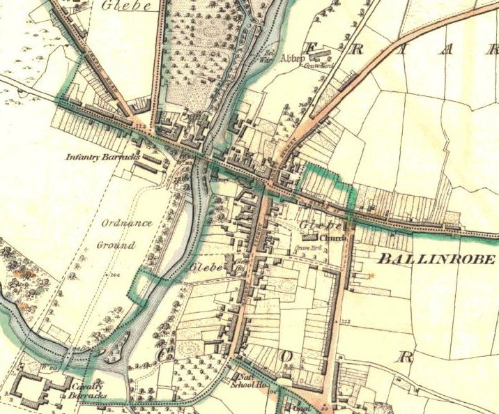 |
Sources: Mayo County Library's digital version of the 1838 Ordnance
Survey Maps of Ireland
http://www.mayolibrary.ie/index.html
and Google Earth satellite images
The population of Ballinrobe in 1838 was about 2,500.
In 2006, the population was about 1,900 people.
Do you expect to see more evidence of building in the older map?
Even when new houses and estates were built, can you see the trace of the 1838 fields?
Traffic is a problem in the town. What route could a bypass take?
Have any new bridges been built over the river in the last 170 years?
Try to look at your own town using Google Earth