
Military Bridge
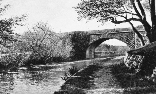
Here's another view of the riverside walk. Is there another reason for the path? There is a clue below.
The bridge was called the Military Bridge. It was built by the English
to link the Infantry and Cavalry Barracks
Why did the British base soldiers in this, and other, garrison
towns in Ireland?
Willie Hughes can remember seeing the soldiers in Ballinrobe
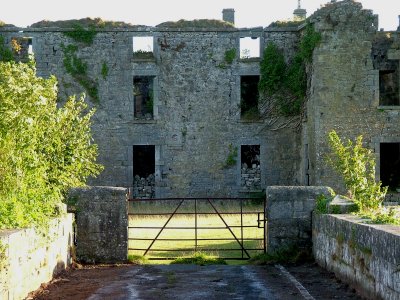
This picture shows the way across the bridge into the Cavalry Barracks. Why is the building destroyed?
Here is a description of the barracks written in 1824 in Pigot's Directory:
"...as a garrison-town it has long been distinguished and is at present the head quarters of a regiment of cavalry. The barracks (once the residence of Lord Tyrawly) stand unequalled, for their beautiful, healthy convenient and romantic situation of the banks of the river Robe, from which the town derives its name."
Cad is féidir linn déanamh leis an bhfoirgneamh anois?: What should be done with this ruin?
Here is a description of the barracks from "A Topographic Dictionary
of Ireland" by Samuel Lewis, written in 1837:
"There are barracks for cavalry and infantry; the former adapted to the accommodation of 8 officers and 106 non-commissioned officers and privates, with stabling for 84 horses; the latter for 6 officers and 96 non-commissioned officers and men, with a hospital for 20 patients."
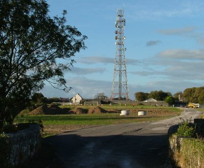
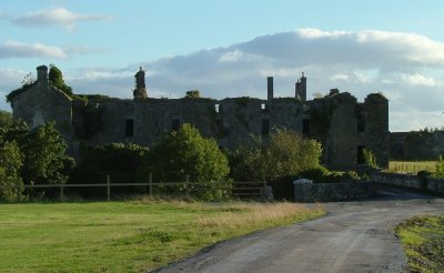
This picture was taken from the Military Bridge looking towards the
Infantry Barracks.
How did the army make use of the green area between the two buildings?
What changes have happened to this part of town?
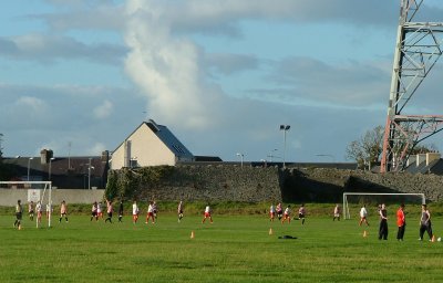
Can you see the small holes in the barrack wall. What were they for?
(Today, the only people shooting are the girls playing soccer above)
 |
 |
Compare the Barracks:
Can you see the changes made to them between 1838 and 1922, the year
they were vacated?
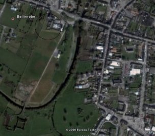
Look at the shape of the wall of the Infantry Barracks circled on the
satellite image
Why is it like this?
Lord Tyrawley of Ballinrobe sold his castle to the War Office in 1821
who then built the barracks
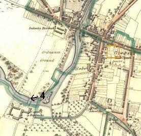
Can you see where it says Ordnance Ground on the map?
What does ordnance mean?
Why, do you think, were the barracks built near the river, all those years ago?