
Floodgates and Mill
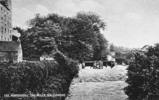
What changes do you expect to see?
Why was the flour mill built beside the river?
Why is there a weir built beside the floodgates? (Ask the fish if you don't know)
Do you think the mill was still in use when the old picture was taken?
Look carefully at it.
The wheel used to drive the mill wasn't directly on the river
A channel was cut to bring water in through the mill in a canal
This water exited under an arch, but this tunnel is overgrown in the
photo from the 20's
Look again at this detail from the modern picture:
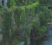
Can you see where the water used to come out?
When Lewis wrote his Topographical Dictionary in 1840, the population
of the town was 2,700.
He referred to the mill, the brewery and a tanyard, all in prosperous
condition.
By 1930, the population had halved. Why did the town decline?
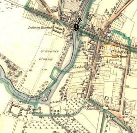
Can you identify the mill on the map?
The brewery is on the other side of the bridge.
Do you think the soldiers would have been good customers for flour and beer?